Geographical analysis of river dynamics in Vila Urlândia, municipality of Santa Maria/RS
DOI:
https://doi.org/10.5902/2236499488343Keywords:
Hazard, Vulnerability, Inundation, Flooding, Margin erosionAbstract
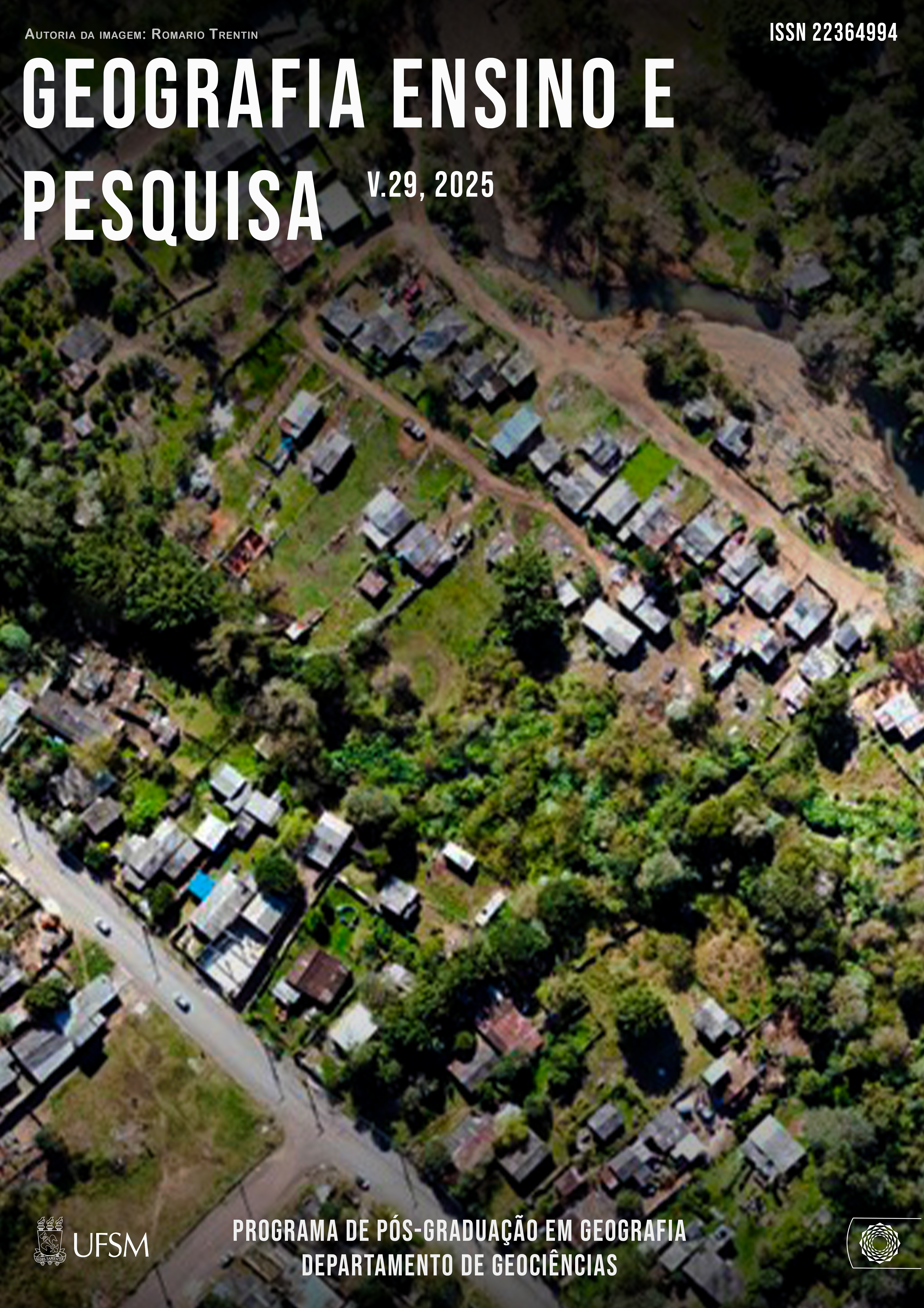
The study area is located in Vila Urlândia and the western part of Vila Santos, in the southern administrative region of the city of Santa Maria, Rio Grande do Sul. The studies aim to map and zone the risk of river processes that could cause harm to the population. Community participation through reports of hydrological events and riverbank erosion, photographic and video recordings, information on recurrences, and other associated problems was crucial in defining the risk of river processes. The area was mapped using an orthomosaic of the village, using aerial photographs taken with a Mavic Air 2 drone, from an aerial survey at an altitude of 150 meters. The risk level is determined by the relationship matrix between the degree of hazard and vulnerability. The data presented show that, in the urban community studied, hydrological processes of flooding and flash floods are predominant, but the possibility of home destruction is more associated with the geological processes of erosion and riverbank undermining. A total of 211 homes were identified as being at high and very high risk. Identifying and analyzing risk areas is essential for adopting measures to minimize or prevent damage and/or loss of life.
Downloads
References
ALCÁNTARA-AYALA, I. Geomorphology, natural hazards, vulnerability and prevention of natural disasters in developing countries. Geomorphology, 47, p. 107-124, 2002. DOI: https://doi.org/10.1016/S0169-555X(02)00083-1
BERGER, M. G. Inundações/Alagamentos na área Urbana de Santa Maria associado a ação antrópica e a distribuição das chuvas entre 1980 e 1995. Monografia de Graduação, UFSM, CCNE, Depto de Geociências. 1999. 80p
BRITO, M. M.; WEBER, E. J.; KRIGGER, V. S.; LEITZKE, F. P. Análise dos fatores condicionantes de movimentos de massa no município de Porto Alegre a partir de registros históricos. Revista Brasileira de Cartografia, Monte Carmelo, v. 68, n. 9, p. 1853-1872, 2016. DOI: https://doi.org/10.14393/rbcv68n9-44450
CARDONA, O. D. Indicadores de riesgo de desastre y de gestión de riesgos. Universidad Nacional de Colombia, Manizales. Instituto de Estudios Ambientales. Banco Interamericano de Desarrollo, 2005.
CRISTO, S.S.V.; ROBAINA, L.E.S.; BERGER, M.G. Análise Ambiental da Bacia do Arroio Cadena, Município de Santa Maria – R|S: Vila Urlândia. Publicado na Rev. Ciência e Natura (ISSN 0100-8307). Santa Maria, 22, 2000. DOI: https://doi.org/10.5902/2179460X27117
CUTTER, S. L. The Vulnerability of Science and the Science of Vulnerability. Annals of the Association of American Geographers, v. 93, p.1-12, 2003. DOI: https://doi.org/10.1111/1467-8306.93101
CUTTER, S.L.; BARNES, L.; BERRY, M.; BURTON, C.; EVANS, E.; TATE, E.; WEBB, J. A place-based model for understanding community resilience to natural disasters. Global Environmental Change Volume 18, Issue 4, October 2008, P. 598-606. DOI: https://doi.org/10.1016/j.gloenvcha.2008.07.013
FERRARI, J. Investigação da morfologia original e antropogênica do Arroio Cadena, Santa Maria-RS. Dissertação. Porto Alegre: IGEO/UFRGS, 2018.
FRANK, B.; BOHN, N. História da gestão do risco e inundações na bacia do Itajaí. In.: MATEDDI, M. A.; LUDWIG, L.; AVILA, M. R. R. (Orgs.) Desastre de 2008+10 no vale do Itajaí: água, gente e política: aprendizados. Blumenau: Edifurb, 2018. p. 117 – 149.
FERNANDEZ, Paulo; MOURATO, Sandra; MOREIRA, Madalena. Social vulnerability assessment of flood risk using GIS-based multicriteria decision analysis. A case study of Vila Nova de Gaia (Portugal). Geomatics, Natural Hazards and Risk, v. 7, n. 4, 2016, p. 1367-1389. DOI: https://doi.org/10.1080/19475705.2015.1052021
GONÇALVES C. D. Desastres Naturais. Algumas Considerações: Vulnerabilidade, Risco e Resiliência. Territorium 19, p. 5-14, 2012. DOI: https://doi.org/10.14195/1647-7723_19_1
MACIEL FILHO, C. L. Carta Geotécnica de Santa Maria. Imprensa Universitária, Santa Maria: UFSM, 1990. 22p
MARCELINO, E. V.; NUNES, L. H.; KOBIYAMA, M. Mapeamento de risco de desastres naturais do estado de Santa Catarina. Caminhos de Geografia, v. 8, n. 17, p. 72-84, 2006. DOI: https://doi.org/10.14393/RCG71715273
REBELO, F. Um Novo Olhar Sobre os Riscos? O Exemplo das Cheias Rápidas (Flash Floods) em Domínio Mediterrâneo. Territorium, v. 15, p. 7-14, 2008. DOI: https://doi.org/10.14195/1647-7723_15_1
RECKZIEGEL, B.W.; ROBAINA, L.E.S.; OLIVEIRA, E.L.A. Mapeamento de Áreas de Risco Geomorfológico nas Bacias Hidrográficas dos Arroios Cancela e Sanga do Hospital, Santa Maria-RS. Geografia, Revista do Departamento de Geociências, v. 14, n. 1, jan./jun. 2005.
ROBAINA, L.E.S.; BERGER, M.G.; CRISTO, S.S.V.; PAULA, P.M. Análise dos Ambientes Urbanos de Risco do Município de Santa Maria – RS. Publicado na Rev. Ciência e Natura (ISSN 0100-8307). Santa Maria, 23, 2001. DOI: https://doi.org/10.5902/2179460X27129
ROBAINA, L.E.S.; RECKZIEGEL, E.W.; RECKZIEGEL, B.W.; BOMBASSARO, M.G. Hierarquização das Moradias com Risco Geomorfológico Associado ao Arroio Cadena – Santa Maria, RS: Estudo de Caso nas Vilas Oliveira, Lídia e Urlândia. Publicado Geografia, Rio Claro, v. 33, n. 1, jan./abr. 2008.
SANTOS, P.P. ·ZÊZERE, J.L.; PEREIRA, S.; ROCHA, J.; TAVARES, A.O. A Novel Approach to Measuring Spatiotemporal Changes in Social Vulnerability at the Local Level in Portugal. Int J Disaster Risk Sci. 2022. https://doi.org/10.1007/s13753-022-00455-w DOI: https://doi.org/10.1007/s13753-022-00455-w
SPODE, P. L. C.; FARIA, R. M. Indicadores de pobreza e privação social na área urbana de Santa Maria, Rio Grande do Sul. Boletim Geográfico do Rio Grande do Sul, Porto Alegre, n. 36, p. 9-29, 2020.
SPODE, P. L. C. Pobreza e privação social na área urbana de Santa Maria, Rio Grande do Sul: uma análise a partir dos usos do território. Dissertação (Mestrado) – Universidade Federal de Santa Maria, Programa de Pós-Graduação em Geografia, Santa Maria, 2020.
TATE, E. (2013).Uncertainty Analysis for a Social Vulnerability Index. Annals of the Association of American Geographers, v. 103, 526-543. DOI: https://doi.org/10.1080/00045608.2012.700616
TOMINAGA, L. K. Desastres naturais: por que ocorrem? In: TOMINAGA, L. K.; SANTORO, J.; AMARAL, R. (Orgs.). Desastres naturais: conhecer para prevenir. 3. ed. São Paulo: Instituto Geológico, 2015b, p. 11-23.
VOJINOVIĆ, Z., GOLUB, D., WEESAKUL, S., KEERAKAMOLCHAI, W., HIRUNSALEE, S. (2014). Merging Quantitative And Qualitative Analyses For Flood Risk Assessment At Heritage Sites, The Case Of Ayutthaya, Thailand. International Conference on Hydroinformatics, New York City, USA.
Published
Issue
Section
License
Copyright (c) 2025 Geografia Ensino & Pesquisa

This work is licensed under a Creative Commons Attribution-NonCommercial-ShareAlike 4.0 International License.
The journal Geografia – Ensino & Pesquisa will obtain the auctorial rights for all published texts. This also implies that the text can be published anywhere in the world, including all rights on renewal, expansion and dissemination of the contribution, as well as other subsidiary rights. The author’s get permission to publish the contribution in other medias, printed or digital, may be in Portuguese or translation, since the publication is credited to Revista Geografia – Ensino & Pesquisa.The journal Geografia – Ensino & Pesquisa will obtain the auctorial rights for all published texts. This also implies that the text can be published anywhere in the world, including all rights on renewal, expansion and dissemination of the contribution, as well as other subsidiary rights. The author’s get permission to publish the contribution in other medias, printed or digital, may be in Portuguese or translation, since the publication is credited to Revista Geografia – Ensino & Pesquisa.